Sierra Golf Community
Almadenes Canyon Route
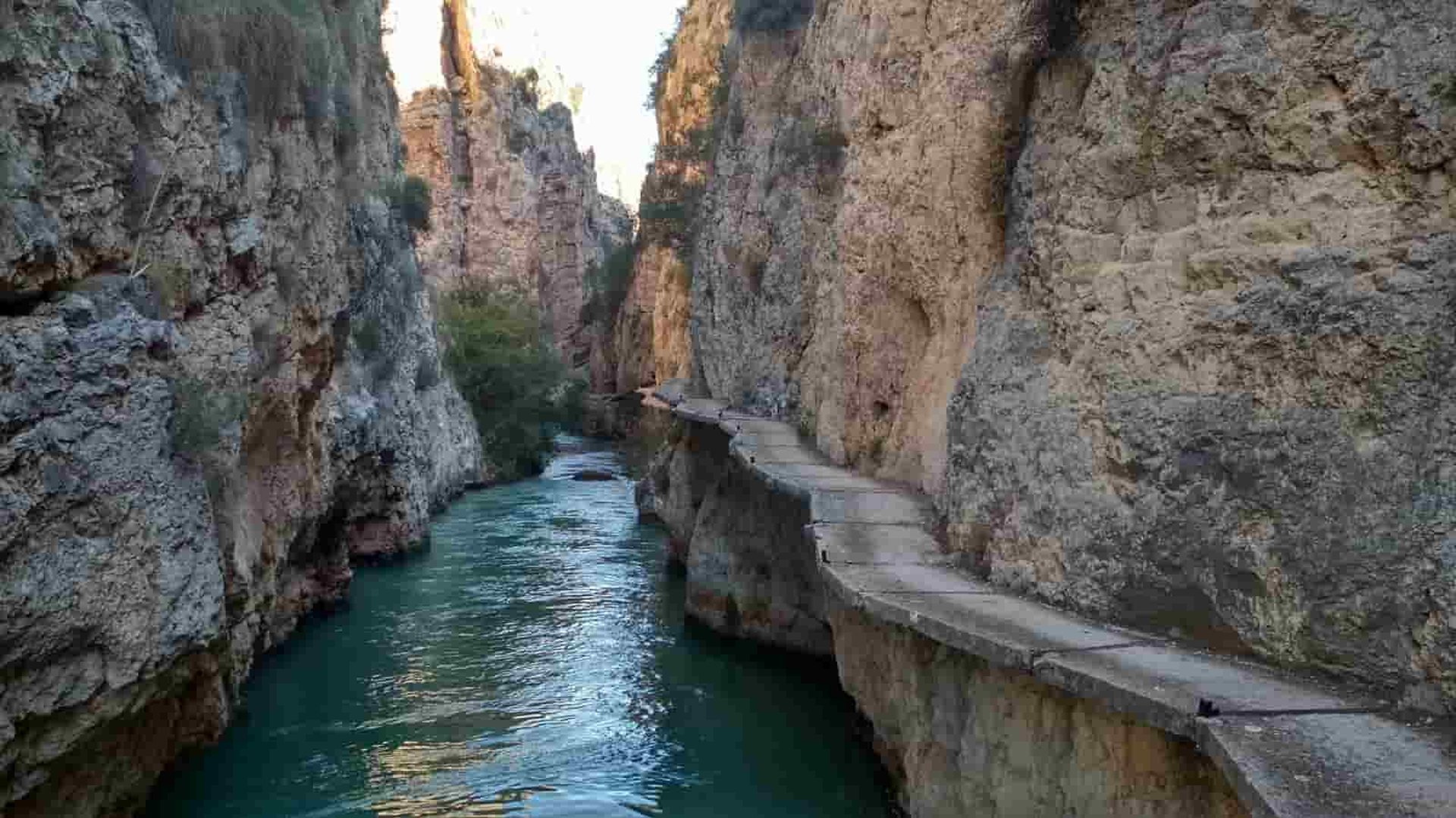
In the municipality of Cieza, close to the province of Albacete border, the Almadenes canyon is a protected natural area. Follow the GR-127 signs that begin near the Almadenes hydroelectric power station if you want to explore this area on foot. The 8-kilometer walk takes roughly two and a half hours to complete.
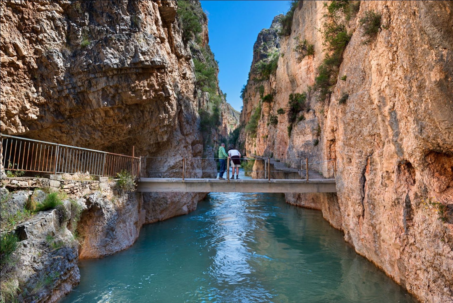
You must cross a footbridge to get to the Mulata reservoir as the path borders the right bank of the Segura river, which created this area. This is a key point for those who are afraid of heights because it goes to a height of 70 meters. It is a circular route, so once you're done, you have to head back that way.
Additionally, you can visit the Serreta cave midway along the path, which contains more than 50 cave paintings from the Palaeolithic era, by making a reservation with the Cieza Town Hall.
Walk on The Edge of Almadenes Canyon
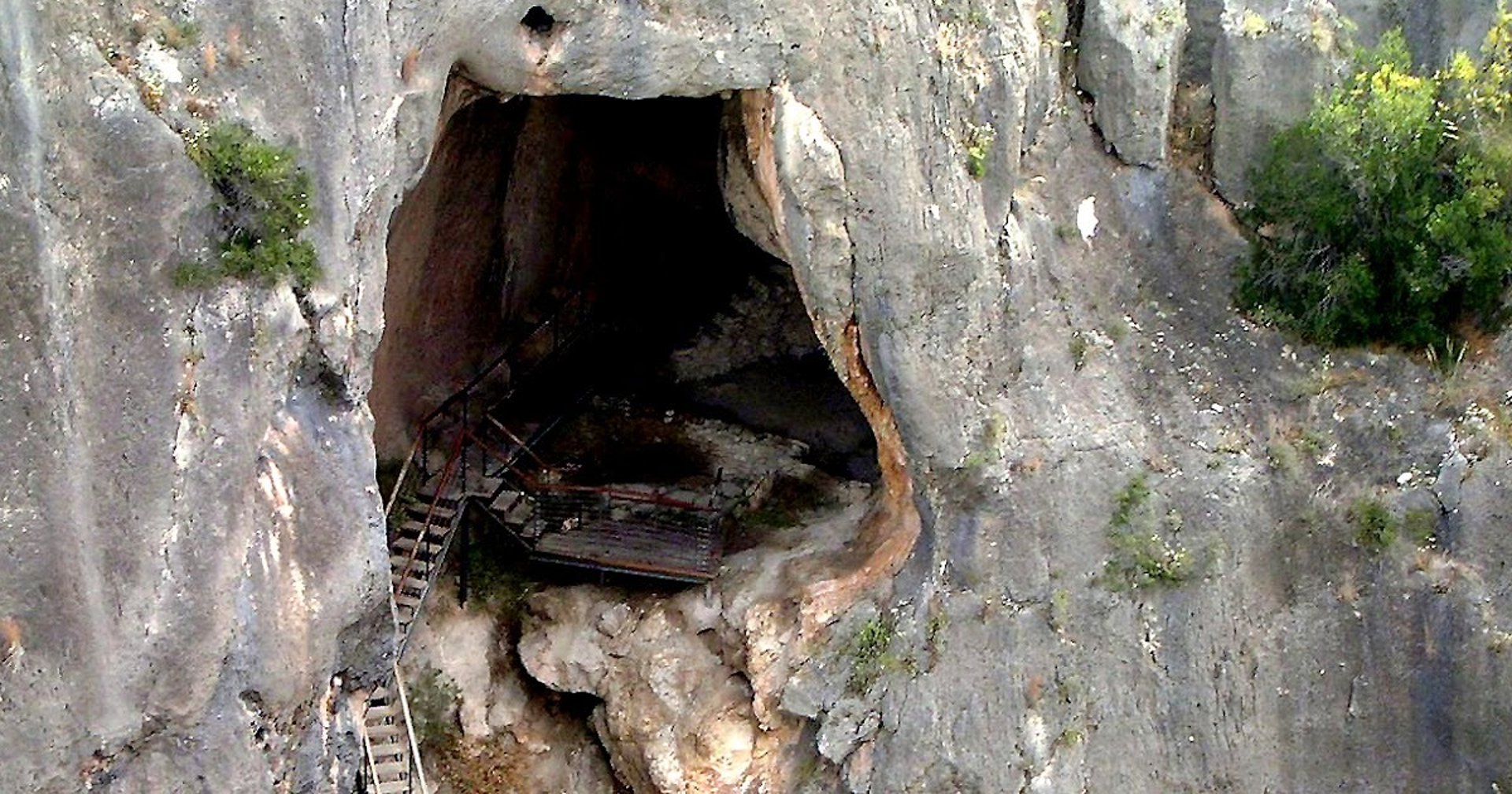
This is one of the most important archaeological sites in the Murcia region, both for the spectacular landscape and for the remains found inside.
It has been adapted for public use and to present to visitors the remains found there, which date from prehistory to the present day.
Its walls contain semi-naturalistic schematic cave paintings from the Post-Paleolithic period (5,000-4,000 BC). Argaric tools have been found in its corners, as well as remains of two Roman houses (3rd century AD), representing the only known Roman cave dwelling on the peninsula, and evidence attesting to its use as a shelter for livestock since the Islamic Middle Ages (10th-12th centuries).
Community
Subscribe Today For Local News, Local Events and Onsite Updates.
(You will NOT receive any spam and your information will not be shared with any third parties.)
Support AND CONNECT
© 2025. All rights reserved.
Get in touch to share news and support our community.
This is your website, so if you know of something that is of interest to others, please share it.
Tell us about a local art group, book club, or a great place you love to visit.